
Written by Dr. Michael Izady. Published 5-9-2016 by The Kurdish Project.
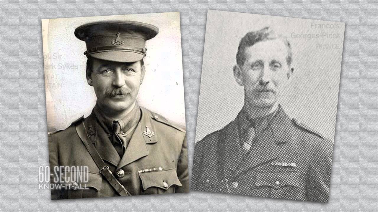
Image via you-tube screenshot.
On May 9, 1916, and as the WWI raged, a secret convention was made between Britain and France, with the later assent of imperial Russia and Italy, for the dismemberment of the Ottoman Empire. The essence of the agreement–expansion of European colonialism into the heart of the Middle East–never came to pass, thanks to the entry of the US into the war at the start of 1918.
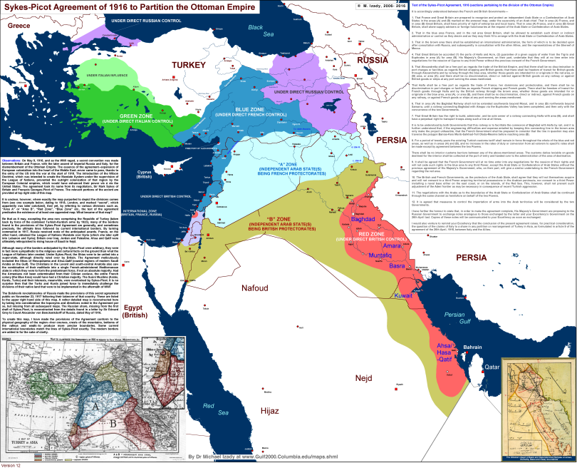
The introduction of the Wilson Doctrine, which was intended to create the Mandate System under the supervision of the League of Nations, prevented the outright colonization of that region by the European Colonial empires, which would have enhanced their power vis à vis the United States. The agreement took its name from its negotiators, Sir Mark Sykes of Britain and François Georges-Picot of France. The relevant portions of the accord are provided at top right side of the full map attached at the end of the article.
Map provided by Dr. Izady and Columbia University
Divisions of Sykes-Picot
It is unclear, however, where exactly the map purported to depict the divisions comes from (see one example below, dating to 1918, London, and marked “secret”, which apparently was later colorized). And yet, by referring to various divisions such as, “Area A” or “Area B”, “Red Zone”, “Blue Zone” etc., the text of the agreement predicates the existence of at least one appended map. What became of that map?
Be that as it may, excepting the area now comprising the Republic of Turkey (taken back by force of the combined Turkish-Kurdish arms by 1923), many of the borders found in the provisions of the Sykes-Picot Agreement are generally, and sometimes precisely, the ultimate lines followed by current international borders. By turning communist in 1917, Russia received none of the anticipated awards. France, on the other hand, obtained the League of Nations Mandate over Syria (which she later split into Lebanon and Syria); Britain over Iraq, Jordan and Palestine. Ahsa and Qatif were ultimately relinquished to rising house of Saudi in Nejd.
Although many of the borders anticipated by the Sykes-Picot were arbitrary, they were in fact more sympathetic to the religious and cultural facts on the ground than what the League of Nations later created. Under Sykes-Picot, the Shias were to be united into a super-state, although directly ruled over by Britain. The Agreement meticulously included the Shias of Mesopotamia and Ahsa-Qatif (coastal regions of modern Saudi Arabia on the Gulf). The Christians in the Levant and south-central Anatolia also saw the combination of their multitude into a single French-administered Mediterranean state in which they were to form the predominant force, if not an absolute majority. Had the Armenians not been exterminated from their Cilician exclave, the entire French colony (the Blue Area) would have had a Christian majority. The Sunni Muslims (Arabs, Kurds, Turks) and their interests, meanwhile, were overlooked by Sykes-Picot. It is no surprise then that the Turks and Kurds joined force to immediately challenge the divisions of their native land that were to be implemented in the aftermath of WWI
The Bolshevik revolutionaries of Russia made the provisions of this secret agreement public on November 23, 1917 following their takeover of that country. These are listed to the upper right hand side of this map. A rather detailed map is reconstructed here by taking into consideration the toponyms and directions noted in the Agreement per se, but missing from all subsequent maps. The Russian share, missing from the first draft of Sykes-Picot, is reconstructed from the details found in a letter by Sir Edward Grey to Count Alexander von Benckenkdorff of Russia, dated May of 1916.
In conclusion, many of the current international boundaries match the anticipated lines by Sykes-Picot, and in fact exactly. But this is more due to natural features of the land–river courses, crests of the mountains, bottoms of the valleys and wadis–than any political expedience on the part of the League of Nations that awarded the mandates to the French and British colonial empires. The United States encouraged to take over formerly designated Russian sector to be labeled as the “Mandate of Armenia” ultimately declined the offer. The US Senate objected to the deal on many grounds to include the rationale and cost of stationing of an estimated 100 thousand American soldiers to guard a distant land largely emptied out of the Armenian Christians by the genocide that had visited on them some years earlier.
About the Author:
Dr. Michael Merhdad R.S.C. Izady is a professor at Columbia University, and one of the world’s leading Middle East cartographers and Kurdish historians.has written numerous books on the Kurdish people, including “The Kurds: A Concise Handbook” which is widely accepted to be the best historical account of the Kurds. In 1996, Dr. Izady wrote and published the Kurdish Manifesto, which was later used as the foundation for the Constitution of the KRG’s Kurdistan Regional Constitution. Dr. Izady also designed the Flag of Kurdistan, which was adopted by the Kurdistan Regional Government. Today, Dr. Izady is a professor at Columbia University School of International and Public Affairs.